
Wildfire
Every structure the fire reached.
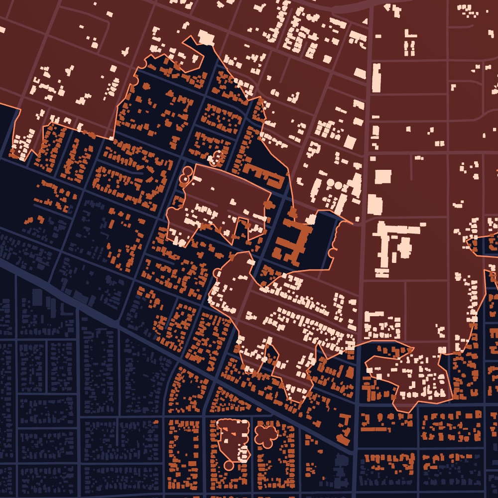
Dorothy follows each wildfire as it grows, maps every structure it reached and shows which ones likely burned.
Flagged structures
High confidenceLikely damagedNot flaggedFire
PerimeterBurn intensity| ZIP | Analyzed | Likely dmg. | Rate |
|---|---|---|---|
| 91001Altadena | 873 | 93 | 11% |
| 91104Pasadena | 1,149 | 226 | 20% |
Likely damaged. Confidence grades how sure we are, not how severe the damage is.
Product view, illustrative. Map data © OpenStreetMap contributors. Records shown are samples.
What it covers
Every wildfire that reaches homes and buildings, followed as it grows.
What you get
Every affected property, how badly it was likely hit, and its owner of record.
Who uses it
Restoration, contractors, asset managers
Per property
What you get for every property.
- Likely damagedEach structure the fire reached, marked likely damaged or not.
- ConfidenceHow sure Dorothy is, structure by structure.
- Burn intensityHow severely the ground around each structure burned.
- Damage rate by ZIPShare of structures likely damaged in each ZIP code.
- Property detailsBuilding type, size, year built and value.
- Owner of recordOwner name, owner type and mailing address.
Property lists
Build the list your team actually works.
Filter every affected property by type, value and severity, then export it or push it to your CRM.
Illustrative. Exports to CSV, HubSpot and Pipedrive.
Example
Eaton Fire, Altadena, California
Discovered January 7, 2025
The Eaton Fire burned 14,021 acres, and more than 10,900 structures sit inside its final perimeter. Dorothy shows which of them likely burned and who owns each one.
- Acres
- 14,021
- Structures inside the perimeter
- 10,933
- Discovered
- Jan 7, 2025
Sample breakdown, for illustration.
How it updates
Updated as the event unfolds.
Every event starts with what is known in the first hours. As new information arrives, and as we run our own analysis, every property is updated.
- HoursFire detected
Structures near the fire are flagged as soon as it starts and is reported.
- DaysPerimeter updates
The burn area is updated as the fire grows, and every structure it reaches is added.
- DaysOur satellite analysis
We analyze imagery from before and after the fire to identify structures that likely burned, each with a confidence level.
- WeeksField inspections
Structure-by-structure field inspections are integrated as they are published, so each property reflects the latest view.
Dorothy shows likely damage. Inspect before work starts.
Storm Reports
Need just one storm? Reports are coming soon.
Every wildfire we model becomes a report: only the impacted properties, each rated by severity, with owners of record, property type and value, and the date of loss. No subscription.
Get early accessEvery impacted property from a single wildfire, each rated by severity, with owners of record, property type, value and the date of loss.
Join the early-access list to hear first when reports open in your states.
Get early access →See wildfire damage in your territory.
Tell us the states and counties you cover. We’ll walk you through recent events and the properties they affected.