
Tornado
Every building inside the path.
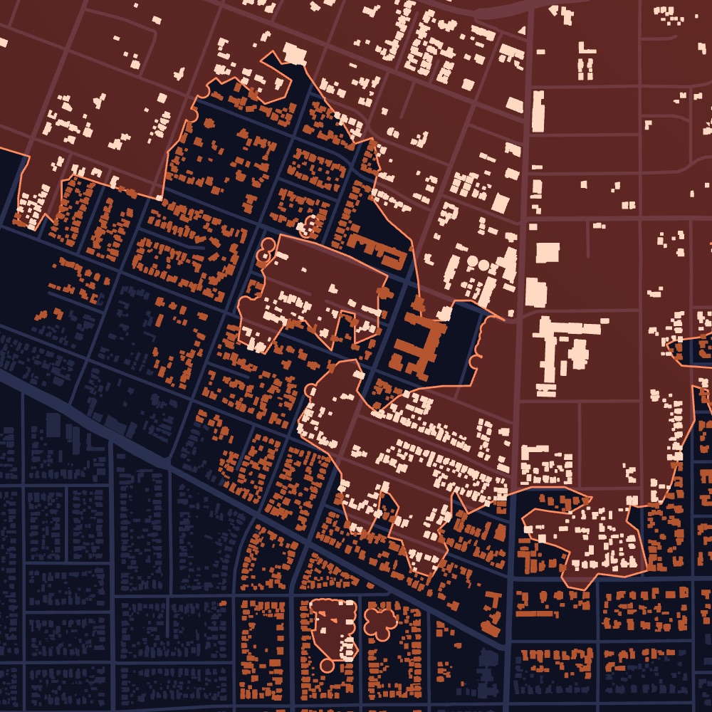
Tornado damage is narrow and severe. Dorothy finds every building in the path and shows how badly each one was likely hit.
Damage footprints
Likely damaged, darker = more severeNot flaggedSelectedDamage swaths (EF)
EF0EF1EF2EF3EF4EF5Product view, illustrative. Map data © OpenStreetMap contributors. Records shown are samples.
What it covers
Every tornado in the U.S., from EF0 to EF5, as soon as its damage path is mapped.
What you get
Every affected property, how badly it was likely hit, and its owner of record.
Who uses it
Restoration, roofing, public adjusters
Per property
What you get for every property.
- Damage zoneThe damage zone each building sits in, EF0 to EF5.
- Path detailsTrack, width, length and date.
- Damage severityHow badly each building was likely hit.
- Wind damage nearbySevere-storm wind damage around the tornado path.
- Property detailsBuilding type, size, year built and value.
- Owner of recordOwner name, owner type and mailing address.
Property lists
Build the list your team actually works.
Filter every affected property by type, value and severity, then export it or push it to your CRM.
Illustrative. Exports to CSV, HubSpot and Pipedrive.
Example
London, Kentucky
May 16, 2025
An EF4 tornado tracked 60 miles across southeastern Kentucky, up to 1,700 yards wide. Dorothy maps every building in the path, the damage zone each one sits in and who owns it.
- Rating
- EF4
- Path length
- 60.1 mi
- Date
- May 16, 2025
Counts of buildings within the path corridor along the full track.
How it updates
Updated as the event unfolds.
Every event starts with what is known in the first hours. As new information arrives, and as we run our own analysis, every property is updated.
- HoursWarning and touchdown
Properties in the warning area are flagged as the storm moves through.
- DaysField damage surveys
On-the-ground surveys are added as they come in, refining the path and its EF zones.
- DaysOur satellite analysis
For every EF3 and stronger tornado, we analyze satellite imagery to identify damaged properties and rate each by severity.
- OngoingYour list stays current
Every update flows to your properties, owners and exports, so your team always works the latest view.
Dorothy shows likely damage. Inspect before work starts.
Storm Reports
Need just one storm? Reports are coming soon.
Every tornado we model becomes a report: only the impacted properties, each rated by severity, with owners of record, property type and value, and the date of loss. No subscription.
Get early accessEvery impacted property from a single tornado, each rated by severity, with owners of record, property type, value and the date of loss.
Join the early-access list to hear first when reports open in your states.
Get early access →See tornado damage in your territory.
Tell us the states and counties you cover. We’ll walk you through recent events and the properties they affected.